7.1. WCS Map Service#
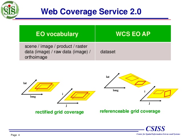
WCS - Web Coverage Service, WCS is a specification for sharing geospatial data in the form of “Coverage” on the Web as defined by the OGC. The so-called “Coverage” refers to data that can return the value of any specified point in its space-time domain, and its form is easy to input into the model for use. The WCS service realizes the sharing of raster image datasets in the form of “Coverage”.
7.1.1. Mapfile definition#
As in WMS and WFS support, WCS publishing is enabled by adding certain
metadata key/value pairs to the .map file.
WMS#
MapServer targets only layers that meet the following conditions and includes them in its WCS function:
the data source is a raster and can be processed using GDAL (eg GeoTIFF, Erdas Imaging, …);
the layer name must be set;
the layer type is set to
RASTER;Web metadata or layer metadata
wcs_enable_requestmust be set;Web metadata
wcs_labelmust be set;must set layer metadata
wcs_label,wcs_rangeset_name,wcs-rangeset-label;Layers can be served via WCS (see MS RFC 67);
The layer projection must be set, even if the projection is set at the map level.
Take a look at the Mapfile used in this section:
 1MAP
 2    EXTENT -180 -90 180 90
 3    SIZE 600 300
 4    SHAPEPATH "/gdata"
 5    OUTPUTFORMAT
 6        NAME "GEOTIFF_16"
 7        DRIVER "GDAL/GTiff"
 8        MIMETYPE "image/tiff"
 9        IMAGEMODE FLOAT32
10        EXTENSION "tif"
11    END
12    WEB
13        IMAGEPATH "/owg/ms_tmp/"
14        IMAGEURL "/ms_tmp/"
15        METADATA
16            "wcs_onlineresource" "https://webgis.pub/cgi-bin/mapserv?map=/owg/mfw8.map"
17            "wcs_keywordlist" "wcs,test"
18            "wcs_enable_request" "*"
19        END
20    END
21    PROJECTION
22        "init=epsg:4326"
23    END
24    LAYER
25        METADATA
26            "wcs_keywordlist" "land, shallow, topo, world"
27        END
28        NAME "world-img"
29        DATA "land_shallow_topo_8192.tif"
30        STATUS OFF
31        TYPE RASTER
32        PROJECTION
33            "init=epsg:4326"
34        END
35    END
36END
7.1.2. GetCapabilities request#
As in WMS and WFS, you can also use GetCapabilities to view the
capabilities of WCS:
Parse the parameters using Python:
>>> [print(x) for x  in url.split('&')]
https://webgis.pub/cgi-bin/mapserv?map=/owg/mfw8.map
SERVICE=WCS
VERSION=2.0.1
REQUEST=GetCapabilities
View the output results in XML format. Only the parts related to version are shown here:
<ows:ServiceType codeSpace="OGC">OGC WCS</ows:ServiceType>
<ows:ServiceTypeVersion>2.0.1</ows:ServiceTypeVersion>
<ows:ServiceTypeVersion>1.1.1</ows:ServiceTypeVersion>
<ows:ServiceTypeVersion>1.0.0</ows:ServiceTypeVersion>
<ows:Profile>http://www.opengis.net/spec/WCS/2.0/conf/core</ows:Profile>
You can see that the versions of WCS are:
2.0.1
1.1.1
1.0.0
7.1.3. DescribeCoverage request#
The DescribeCoverage request lists more information about a specific
coverage product.
The parameters are described as follows:
>>> [print(x) for x  in url.split('&')]
https://webgis.pub/cgi-bin/mapserv?map=/owg/mfw8.map
SERVICE=WCS
VERSION=2.0.1
REQUEST=DescribeCoverage
COVERAGEID=world-img
The parameters vary greatly between different versions, and the returned results are also different. You can open the link to have a look at it:
WFS 1.0.0:
Parse the URL:
>>> [print(idx, x) for idx, x  in enumerate(url.split('&'))]
0 https://webgis.pub/cgi-bin/mapserv?map=/owg/mfw8.map
1 SERVICE=WCS
2 VERSION=1.0.0
3 REQUEST=DescribeCoverage
4 COVERAGE=world-img
WFS 1.1.1:
Parse the URL:
>>> [print(idx, x) for idx, x  in enumerate(url.split('&'))]
0 https://webgis.pub/cgi-bin/mapserv?map=/owg/mfw8.map
1 SERVICE=WCS
2 VERSION=1.1.1
3 REQUEST=DescribeCoverage
4 IDENTIFIERS=world-img
7.1.4. Usage of GetCoverage#
GetCoverage returns data, which is raster data. Since the request
cannot specify the name and suffix of the file at this time, the file
can be downloaded and saved, and modified into a file with .tif as
the suffix. This file has geospatial information.
The parameters are decomposed as follows:
>>> [print(idx, x) for idx, x  in enumerate(url.split('&'))]
0 https://webgis.pub/cgi-bin/mapserv?map=/owg/mfw8.map
1 SERVICE=WCS
2 VERSION=1.1.0
3 REQUEST=GetCoverage
4 IDENTIFIER=world-img
5 FORMAT=image/tiff
6 BOUNDINGBOX=43,33,44,34,urn:ogc:def:crs:EPSG::4326
GetCoverage return image#
GetCoverage can also directly return the image, just modify
format=image/png . However, it should be noted that the returned
image must be returned by a separate request in the web, and cannot be
used in the web page as an <image> object.
The following is an example, the picture in the web page, which cannot be displayed here. But by “right click” -> “view image”, you can see that it is a picture.
Result of WCS#